
According to Live Science, an update from the European Centre for Medium-Range Weather Forecasts (ECMWF) in early June indicates that the upcoming weather event will be the strongest El Nino ever recorded. The Nino 3.4 index (a measure of sea surface temperature anomalies between 5 degrees north and 5 degrees south and between 120-170 degrees west) shows that sea surface temperatures in the equatorial Pacific region rose more than 1 degree Celsius above normal by the end of May. ECMWF forecasts that sea surface temperatures will increase more than 3 degrees Celsius above average by December, potentially exceeding 4 degrees Celsius in some cases.
Although meteorological agencies typically base their official announcements of El Nino on a sustained increase in sea surface temperatures for at least three consecutive months, the atmospheric changes related to this phenomenon have already begun to occur. If the forecast is accurate, this year’s El Nino will be significantly stronger than the previous records of 2015-2016 and 1997-1998. During those two El Nino events, the Nino 3.4 index recorded a temperature increase of 2.3 degrees Celsius above average.
According to Economics Times, the ECMWF’s findings align with observations from several international weather agencies. Last month, U.S. government climate research institutes estimated an 82% chance of El Nino developing between May and July. Meanwhile, the Australian Bureau of Meteorology reported that temperatures in the equatorial Pacific were 0.67 degrees Celsius above average by the end of May.

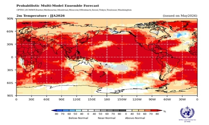
The forecast for air temperatures from June to August by WMO indicates areas in red signify higher than normal temperature increases. Photo: WMO
The El Nino event occurs every 2-7 years, part of the natural climate cycle known as the El Nino-Southern Oscillation (ENSO) in the Pacific. The ENSO cycle alternates between the warm phase of El Nino and the cold phase of La Nina, with neutral phases in between. El Nino causes higher sea surface temperatures in the central and eastern Pacific, weakening or reversing trade winds, disrupting global temperature and rainfall patterns. The most recent El Nino event on Earth lasted from June 2023 to April 2024, making 2024 the hottest year on record and the first year of warming to exceed 1.5 degrees Celsius, as outlined by the Paris Agreement on climate change. Previous El Nino events have severely impacted global agriculture, leading to famine in Europe, triggering civil wars in tropical regions, along with droughts, floods, and wildfires worldwide.
In an update on June 2, the World Meteorological Organization (WMO) warned that there is an 80% chance of El Nino forming before September and a 90% chance before November. “The El Nino conditions will be like ‘adding fuel to the fire’ in a warming world. The impacts will be more severe, widespread, and cross borders with devastating speed,” emphasized United Nations Secretary-General António Guterres.
Scientists are monitoring whether the warming trend will continue through June, July, and August. If temperatures continue to rise significantly, meteorological agencies will announce the emergence of El Nino in the near future.
An Khang compiled the report.