
Information was announced at the conference to implement the pilot smart urban model at the commune level organized by the People’s Committee of Ho Chi Minh City on June 11. The pilot localities are Phu Nhuan Ward, Vung Tau Ward, and Con Dao Special Economic Zone. After one month, the model will be re-evaluated, aiming to form a smart urban governance model to replicate throughout the city.
Mr. Lam Dinh Thang, Director of the Ho Chi Minh City Department of Science and Technology, stated that the commune-level smart urban model applies platforms such as the Intelligent Operation Center (IOC) and Digital Twin. The system helps digitize management, centralize data, and monitor in real-time various fields such as security, traffic, planning, land, and socio-economic aspects. As a result, local leaders can make faster and more accurate decisions based on real data instead of manual reports.

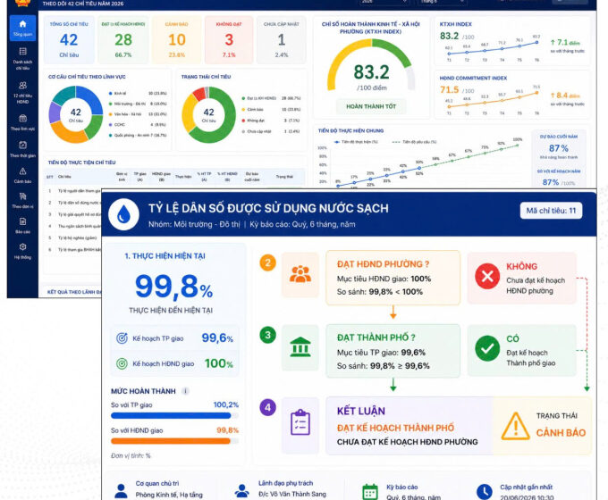
The simulation of the Dashboard system for economic management of Phu Nhuan Ward and Vung Tau, implemented in collaboration with Viettel. Photo: BTC
The simulation of the Dashboard system for economic management of Phu Nhuan Ward and Vung Tau, implemented in collaboration with Viettel. Photo: BTC
The three pilot localities are divided into two groups of models suitable for the current status of digital infrastructure, data, and management needs at the grassroots level.
The first group is the “Comprehensive Digital Transformation of Con Dao Special Economic Zone – Smart Special Zone” model implemented by Vietnam Technology and Communication Joint Stock Company (VNTT), a member of the Becamex group. The initial phase of the project has completed the Intelligent Operation Center, a smart special zone management platform applying Digital Twin technology, a socio-economic reporting system, and security and traffic monitoring. All management data is integrated on a digital map, supporting leaders to monitor the situation and manage centrally.
The second group is being implemented in Phu Nhuan and Vung Tau wards with the participation of Viettel Group. The two localities will pilot the Dashboard system for management and the Digital Twin solution for urban monitoring. The Dashboard allows real-time monitoring of socio-economic development indicators, automatically compiles reports, alerts for delayed indicators, and supports leaders in decision-making based on digital data. Phu Nhuan Ward is expected to monitor 45 indicators, while Vung Tau Ward will monitor 42 indicators.
The Digital Twin system will connect existing cameras, using artificial intelligence to recognize license plates, detect traffic violations, encroachments on sidewalks, improper waste collection, identify unusual crowds, or violent behaviors for early warning…
In Vung Tau Ward, the model will also be expanded to alert residents and tourists when swimming in dangerous sea areas.

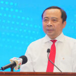
The urban management solution was introduced by Viettel at the conference on the morning of June 11. Photo: An Phuong
The urban management solution was introduced by Viettel at the conference on the morning of June 11. Photo: An Phuong
Mr. Nguyen Manh Cuong, Vice Chairman of the People’s Committee of Ho Chi Minh City, stated that the pilot program arises from practical needs as the city operates the two-tier local government model. Urban management currently still relies on experience and manual information compilation, while many issues could be handled more effectively if managed on a digital data platform.
Citing the land sector as an example, he argued that managing with digital data linked to coordinates would help accurately determine boundaries and areas of land lots, reduce errors in documentation, and avoid overlapping land boundaries. Meanwhile, traditional management mainly relies on paper records and manual measurements, which can lead to discrepancies. There are projects that differ by only 2-3 square meters from the records but still require adjustments to all procedures, affecting implementation progress. Therefore, the city hopes that the smart urban model will facilitate management based on accurate data, rather than relying heavily on experience as in the past.
City leaders believe that the goal of the model is not only to apply technology but also to transform governance methods from experience-based operations to data-driven operations. When data is connected and updated in real-time, the government can forecast, monitor, and make faster and more accurate decisions, thereby improving the quality of service for residents and businesses.
The city will also study expanding the issues related to the environment, tourism, technical infrastructure, social security, flood warnings, resource management, and other specialized fields.